Our Services
Exploratory Investigation Borehole
Vertical Hole Drilling
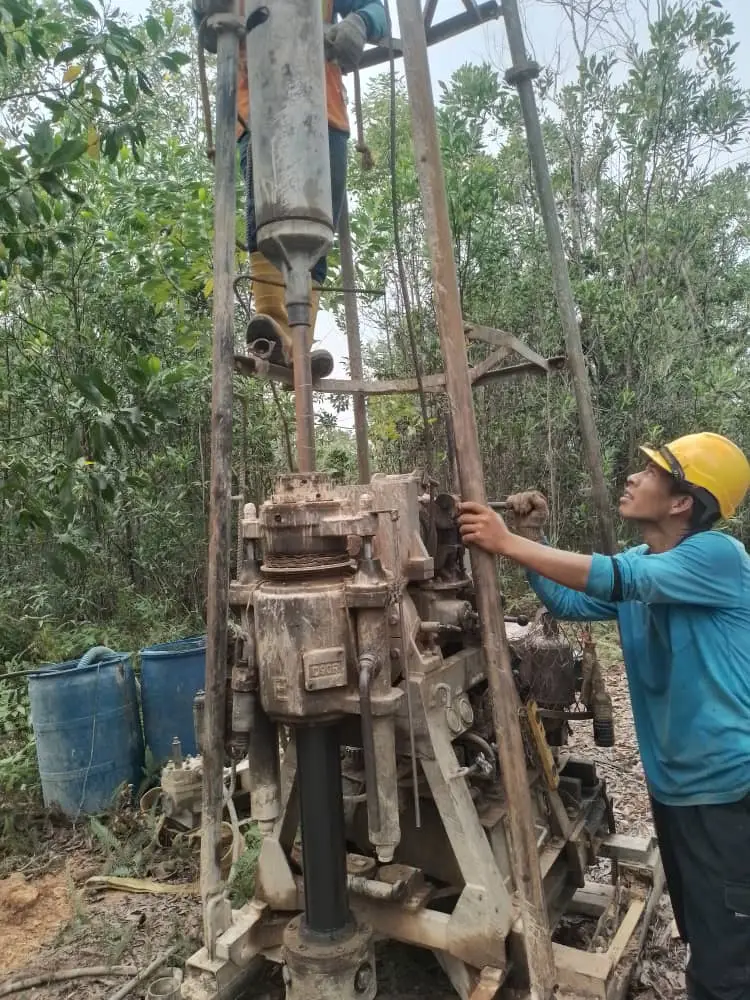
Soil investigation via vertical hole drilling involves drilling a borehole to collect soil samples and assess subsurface conditions. The steps include planning, equipment setup, drilling, sample collection, soil logging, in-situ testing, borehole completion, laboratory testing, and data analysis. This method helps in foundation design, slope stability assessment, construction feasibility, and environmental evaluations. Proper soil investigation is crucial for ensuring the safety and success of construction projects.
Horizontal Hole Drilling
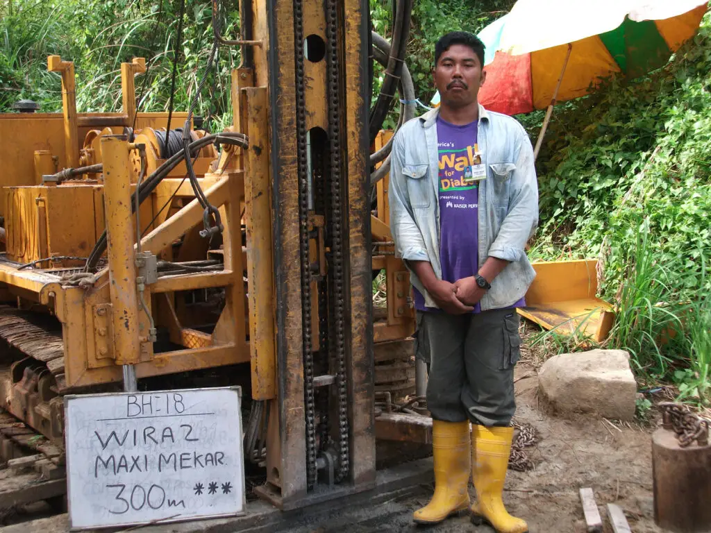
Horizontal hole drilling involves drilling horizontally into the ground to assess subsurface conditions across a wide area. This technique allows for the collection of soil samples and data from different depths and locations without extensive surface disruption. It is particularly useful for evaluating soil and rock properties, especially for tunnel portal construction and quarrying. Our company holds a record of reaching 150 metres depth in horizontal hole drilling.
Inclined Hole Drilling
Inclined drilling, also known as or angled drilling, is a technique where boreholes are drilled on a inclined position between 45 to 80 degree to a depth to 200m with NQ size casing and wireline core barrel. This method is used in various applications, including mineral exploration, geotechnical investigations, and etc.

Deep Drilling
Deep drilling within the range of 150 to 300 meters using NQ size casing is a common practice in geological and geotechnical investigations, as well as mineral exploration. The NQ size refers to a specific diameter of drill casing and core, which is a standardized size in the drilling industry.
Pontoon
Soil investigation on a pontoon involves conducting geotechnical surveys from a floating platform. This method is used to assess subsurface soil and rock conditions in aquatic environments, such as rivers, lakes, or coastal areas. The pontoon provides a stable base for drilling rigs and testing equipment, allowing engineers to collect soil samples, conduct in-situ tests, and evaluate the geotechnical properties of the seabed or riverbed for construction projects like bridges, piers, and jetty structures.
Swampy
Operating a drilling rig in a swampy area presents unique challenges due to the soft and saturated ground conditions. To address these challenges, wooden staging or platforms are often constructed to provide a stable and safe working surface for the rig and personnel. This approach requires careful planning and execution to ensure safety, efficiency, and minimal environmental impact.
Continuous Sampling
Continuous sampling drilling (CSD) is a technique used in geotechnical, environmental, and exploration drilling to obtain continuous core samples. This method enables detailed and accurate subsurface analysis. In geotechnical engineering, CSD helps determine the mechanical and physical properties of subsurface materials for construction projects. In environmental studies, it monitors contamination levels and assesses environmental conditions. In mineral exploration, CSD evaluates the presence and quality of mineral deposits, providing essential data for resource assessment.
In-situ Testings

Standard Penetration Test
The Standard Penetration Test (SPT) is one of the most commonly used in situ tests in geotechnical engineering. It provides valuable information on soil properties, such as relative density, strength, and bearing capacity.
Permeability Test
Permeability tests in soil are used to determine the rate at which water can flow through soil pores. This is an important parameter in geotechnical engineering as it affects the design of foundations, retaining structures, slopes, and groundwater control systems. Falling head, rising head or constants head methods will be implemented at site.
Lugeon Test
The Lugeon test, also known as the water pressure test or packer test, is an in-situ test used to assess the permeability of rock formations, particularly in the context of dam foundations, tunnels, and other underground constructions. the test helps in evaluating the hydraulic conductivity of rock masses, which is crucial for the design and safety of hydraulic structures.
Pressuremeter Test
A pressuremeter test measures the in-situ stress-strain response of soils and rocks. It involves inserting a cylindrical probe into a borehole and inflating it to apply radial pressure to the surrounding material. The resulting deformation is recorded, providing valuable data on the material’s stiffness, strength, and deformability, essential for designing foundations and other geotechnical structures.
Vane Shear Inside Borehole
The vane shear test is an in-situ test used to measure the shear strength of cohesive soils, particularly soft clays. It is commonly used in geotechnical engineering to determine the undrained shear strength of soil, which is essential for foundation design, slope stability analysis, and other soil stability assessments.
Televiewer
The televiewer test, also known as borehole televiewer logging, is an advanced geophysical logging method used to create detailed, high-resolution images of the walls of a borehole. This test provides critical information about the geological features and conditions within the borehole, such as fractures, bedding planes, and other structural features.
Cone Penetration Test
Cone Penetration Test
The Cone Penetration Test (CPT) is a widely used in-situ testing method in geotechnical engineering to determine the geotechnical properties of soils. It provides continuous profiles of soil resistance, allowing for detailed subsurface characterization, which is crucial for the design and analysis of foundations, embankments, and other geotechnical structures.
Inclinometer
Inclinometer Installation & Monitoring
Inclinometer monitoring is a geotechnical measurement technique used to monitor the deformation and movement of soil, rock, and structures. This method is particularly useful for assessing the stability of slopes, embankments, retaining walls, and other geotechnical structures. The primary goal of inclinometer monitoring is to detect and measure lateral displacements that may indicate potential failures or instabilities.
Rock Probing &
Fissure / Compaction Grouting
Fissure Grouting
Fissure grouting is a specialized technique used to stabilize rock masses, seal cracks and fissures, and control groundwater flow. This method involves injecting grout into rock fissures to fill voids, consolidate fractured rock, and create a watertight barrier. It is commonly used in tunneling, dam construction, mining, and other civil engineering projects where controlling water and stabilizing rock formations are critical.
Compaction Grouting
Compaction grouting is a ground improvement technique used to increase the density, strength, and stability of soils. This method involves injecting a stiff, low-mobility of cement mortar into the ground under high pressure to displace and compact the surrounding soil. It is commonly used for foundation support, settlement control, and void filling. Mainly apply in Limenstone formation for cavity treatment.
Jack-in Penetration Vane Shear
Jack-in Penetration Vane Shear
The Jack-In Penetration Vane Shear Test is a field test used to determine the in-situ shear strength of cohesive soils, particularly clays. This test involves inserting a four-bladed vane into the soil and rotating it to measure the torque required to shear the soil along a cylindrical surface. The results provide valuable information about the soil’s undrained shear strength, which is crucial for foundation design, slope stability analysis, and other geotechnical applications.
Trial Pit
Trial Pit
A trial pit is a crucial method in soil investigation used to study the subsurface conditions at a construction site. It involves digging a pit, typically with dimensions ranging from 1 to 4 meters in depth, to allow for direct observation and sampling of the soil. The image on the right shows a collected undisturbed block sample.
Hand Auger
Hand Auger
A hand auger is a portable, cost-effective tool used in soil investigations to collect samples and examine soil layers up to 5 meters deep. Ideal for preliminary assessments, geotechnical studies, and environmental checks, it involves rotating the auger into the ground and periodically extracting it to clear soil. Though requiring manual effort and potentially disturbing samples, it offers minimal site disturbance and valuable data for various applications.
Mackintosh Probe Test
Mackintosh Probe Test
The Mackintosh Probe Test is a field test used primarily to assess the consistency and relative density of soft to medium cohesive soils. It is a simple, rapid, and cost-effective method suitable for preliminary site investigations, particularly in remote or undeveloped areas.
